SVG + POI
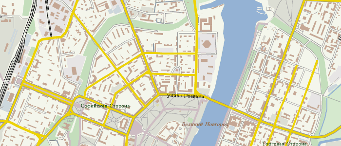
Тут в комментариях skoworodker раскопал у 123map хороший сайт (если бы не флэш — был бы отличным), совмещающий векторный рендеринг с генерализацией линий и отбражение выбранных POI, как в недавней xapi-смотрелке. Привет тем, кто знает немецкий.
апдейт: в комментарии пришёл автор сайта.
апдейт: в комментарии пришёл автор сайта.
I’m one of the makers of this site. You can also download files via the Download-Button for use of the maps in Illustrator or Inkscape. The resulting files have layers for easy editing. You can easily use this files to produce maps for high quality prinitng. Sorrily the switches for the POIs are only available in German in the moment. There will be an englisch version someday...
Detlev
Максимальный зум (ползунком справа) вымораживает. :3
If you haven’t seen it yet, there is a thematic map «Public transport». There will be more thematic maps in the near future. Updates were done from the planet-file once a week.
We are just planning a PlugIn for jQuery which allows interaction with the SVG map in both directions. We also think about making this PlugIn OpenSource. The engine is not OpenSource and nobody knows about tomorrow ;)
There are couple of more questions for you in comments: one in English from skoworodker and another is bug report from Danidin9: because of generalization, some POI are shifted into nearby nodes.
Could you make a displaying of information about POI some other, like: Germany, Berlin, Alexander platz instead of addr:country=de, addr:city=Berlin, addr:street=Alexander platz ZB? Now you have lighting a website tag, but i want more :)
open_hours tag may present as list of days with time near it (as signboard in the store).
поправьте меня если кто в английской грамматике понимает лучше:)
Surely we can parse the OSM tags to build an application that will better show informations for end users. But the intention of this map application is to show mappers the real tags used for the POIs. So it is easy to find defects for a POI mapper. Editing is easy done because you can open your favorite editor with the actual frame directly from the information dialog or with a right mouse click on the map.
The generalization of lines and polygones is done in realtime. This means we use only high resolution data, than we look for the screensize on which the map tile shood be displayed. After that we clip the tile and than generalization is done in dependance of the resolution for every element in the tile, but not for the POIs. All this works on the fly, so we can have hundreds of different maps and styles with only one server.
For the POIs we have build in a collision detection. This means if one POI touches another, we don’t show the touching POIs. In case of this the position can shift, but this is a function. It is not finished on our new server, but I give you a link were you can see the functionality fully implemented:
http://www.rossmann.de/services/filialsuche.html
Put your mouse over an POI with a lens symbol, than you will see the full function we will implement in the near future.
Thank you for your mail. If there is anyone out in Russia who would like to translate our map application to Russian, please send me a mail adress directly. I will send this guy some XML files for translation and we will make this application work in Russian speech. This will only take a day I think.
how about adress? (email)